Arlington
Just south of Lindley in the Freestate or 50 km north west from Bethlehem is this little place with a few streets and houses, calling it a town would be overstating it. Next door to it is the much bigger and more populous town called Leratswana. But that only came into existence a few years ago and is thus of not much interest to us. GPS coordinates: 28.0296°S 27.8514°E elevation: 1570m
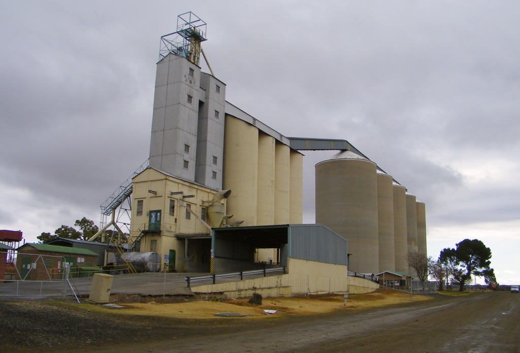 Our visit to it was in July 2012. Overpowering the village are the huge silos which would be the main attractions here. But then what else is there?
History
The information on the history of the village I have gathered from a brochure called: “Lindley Road
1904 tot Arlington 2006”, which is available from Annetjie at the corner cafe opposite the silos.
The village essentially started with the railway line. The Harrismith-Bethlehem line was extended in 1906 and taken through to Kroonstad, a siding was established on the farm Port Arlington to service the towns of Senekal and Lindley. The siding was named Lindley Road and became a transport hub for post and passengers to Senekal and Lindley. It is known that a daily shuttle by ox-wagon operated between the siding and Lindley. A village started to develop and by 1910 it already had a police station, a post office, a bank (Standard Bank, see picture) and a few shops, as well as residential houses. At some stage the village was called Arlington and the station changed its name as well. It officially became a village in 1930, although even before that there was a village management council.
Searching the Internet does not provide much more information, Wikipedia has a bit of a story, but it has obviously been written by the ANC since it just moans about the fact that the original town was created by Apartheit (it happened long before Apartheit) and that there are far too few non-white people living in the actual village of Arlington. I hate this sort of political and racial look at things.
A better link to Arlington is by clicking the Riemland route.
Churches
There is the Nederduits Gereformierte Kerk (NG church), that one was built in 1978. It's thus
a fairly new church, new because Arlington used to be part of the Lindley congregation and only became their own in 1963. The church hall to serve the local community was built in 1953.
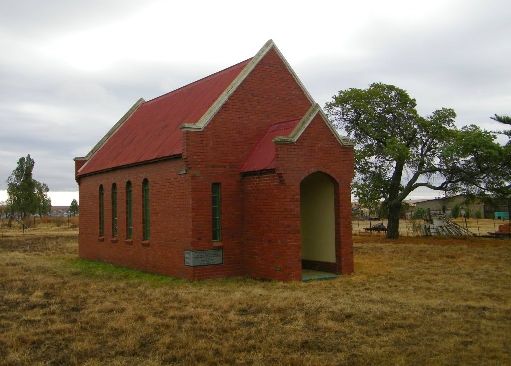 The other church is a privately built and owned church, erected in 1946 by Florie Bobbert who had it built
so that her children could be christened there. Inscription on the corner stone:
The other church is a privately built and owned church, erected in 1946 by Florie Bobbert who had it built
so that her children could be christened there. Inscription on the corner stone:
This church of St.Andrews
was consecrated by the
RT.Rev Howe-Brown
Lord Bishop of Bloemfontein
Glory of God
on 27-12-1946 AD
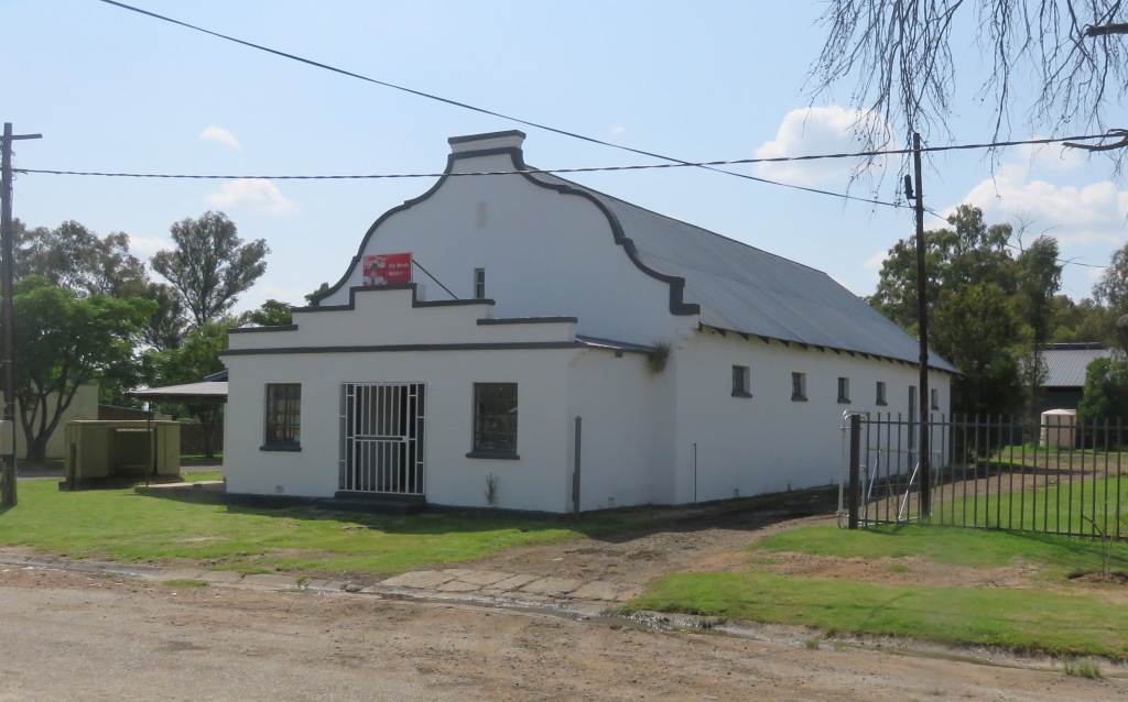
the oldest house
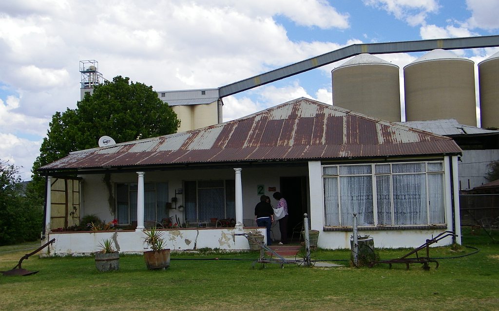 The oldest residential house in Arlington, that is the claim of the present occupants. It would have been built around the early years of the 20th century.
Cemetery
 Inquiring in town about a cemetery initially drew a blank until one of the inhabitants directed us to the place. Go out of town and just before you cross the rail line to Lindley look left. And there it was. The names we could read were Alexander, Barrat and Montgomery.
Standard Bank
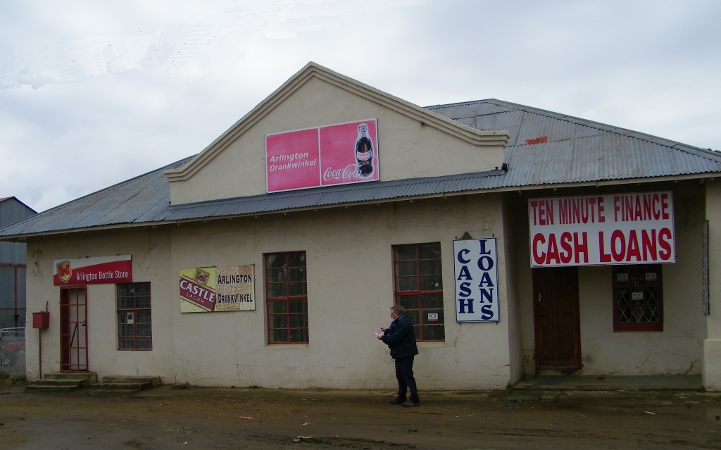 One of the early buildings to house the Standard Bank, erected in 1904. In those early days it was open for one day a week. It now houses the Bottle Store and the Cash Loans from where Colin has just managed to obtain a loan to take over to the bottle store.
Railway Station
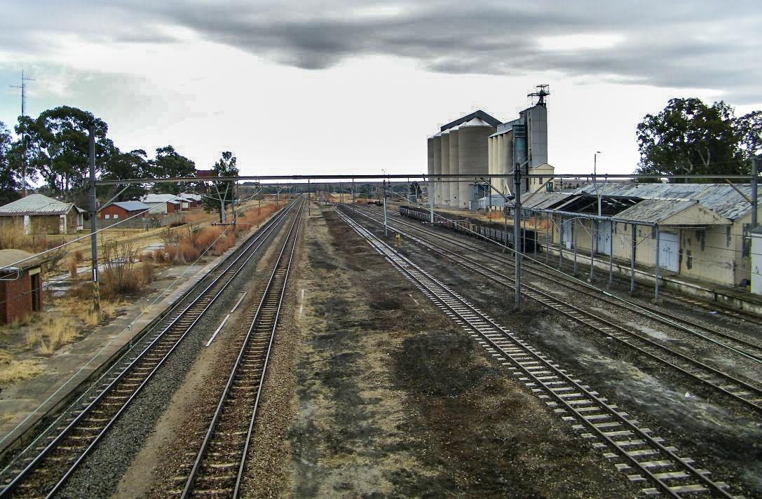 Much bigger now than when it was just a siding in 1906. Two new rail links from here, was 1913 to Senekal and 1929 to Lindley. This would certainly have brought more traffic to and from this station
The picture shows the view from the bridge over to the west.
School
 A primary school was first opened in 1908, initially in a provisional building. The sand stone structure seen in the picture was erected in 1910, its cost was £806. The school was closed in 1991.
It is now part of the police station.
Townhall
 In 1930 the village was declared a municipality, which led to a town hall being build in 1933.
Reference:
Rev 1: 'Lindley Road 1904 tot Arlington 2006', brochure available in the village
Rev 2: 'The Orange Free State - its pastoral, agricultural and industrial resources', compiled by Somerset Playne, printed by the foreign and colonial, compiling and publishing company, 1912