Christiana
A small town on the banks of the Vaal River about 100 km north of Kimberley. Its Geo-position: 27.9151°S, 25.1626°E and 1201m above sea level.
History
Why does Christiana exist, there is an interesting story. Diamonds had been discovered in the area of nowadays Kimberley and further north. With the British showing an interest it was decided by the government of the Transvaal at the time to establish a town as far west along the Vaal river as possible to fore-come any British expansion. It was established on the farm Zoutpandrift, the owner was Christiaan Hattingh. This gives rise to the reason for the name. But more common it is beliefed that the name comes from the president's (MW Pretorius) daughter, Christina.
It looks like the developing town was initially administered by a magistrate, in ref 1 it states that it got a health committee in 1895 and received municipal status 1904.
The reason why the town was established became true in 1872 when the first diamonds were discovered in the gravel of the river nearby. 1891 a public digging was declared on the towns commons. I could not find any information on how successful that was. Another diamond rush occurred 1903. It is reported that at one time they were even looking for the stones under the old church.
Emil Holup was here, he passed through the area in 1872 and describes what he found in his book, ref 3. I have translated the relevant section and present it here. It makes interesting reading.
The following morning, after treating ourselves to the benefit of a bath in the Vaal River, we set off in an east-northeast direction to the Transvaal Republic. Sooner than I expected, after just two hours of driving, we came across some buildings on the right bank of the Vaal. Coming closer, we found an elongated brick house covered with sheet iron, a second artificial building made of earth and piles that threatened to collapse at any moment, and a third house made of burnt bricks with a flat roof. These buildings, 2 tents and 13 Koranna huts, located at three different ends of the measured future city, formed the sea of houses in the westernmost cities of the republic in 1872, which later became quite widespread due to the unrest in the country of Gassibone and among the nearby Korannas in South Africa well-known Christiana. The first-mentioned house was the Landdrost's (magistrate) apartment and at the same time the office of the highest civil and military authority in the Bloemhof district. The second, small, covered with a flat tiled roof, housed a general store and, if I am not mistaken, the sheriff lived in the dilapidated house. In one tent the police force subordinate to the sheriff for the towns of Christiana and Bloemhof and for the entire district - in total a black man. In the second tent a few Bricklayers who were brought in to build a public building, I think a windowless prison.
Since the time of my first visit to the Transvaal Province, much has changed in Christiana, and for the better, so that the town currently rivals Bloemhof in importance, which in 1876 had about 30 houses. The rapid development of Christiana, apart from the town's favorable location on the road leading from Griqualand to the Transvaal Province, is essentially a credit to his magistrate, whom I later had the pleasure of making the acquaintance of. I can only say that under the Republic he performed his duties very well in difficult circumstances, neighbouring several restless native tribes. So that he was retained in his office even after the annexation by the English.
NG church
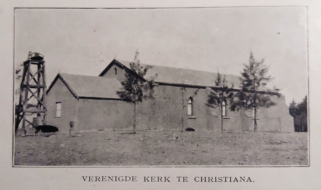
 As church members settled in the area they were part of the Bloemhof congregation. The first attempt to have a congregation around and in Christiana failed, mostly due to still low numbers making it financially unsustainable. When that was the source, Ref 2, does not say. A pointer could be the picture of the old church, underneath it is titled "Verenigte Kerk" (United Church). This refers to the union between the two streams of the Afrikaans churches, Gereformierde and Herformde Kerk. The union was negotiated in 1885, but not long after it started falling apart again, by 1895 the split was complete. Thus this old church was most likely built between 1885 and 1895. At that time they were still an outpost of the Bloemhof congregation. Finally, in 1898 the Christiana congregation was successfully established.
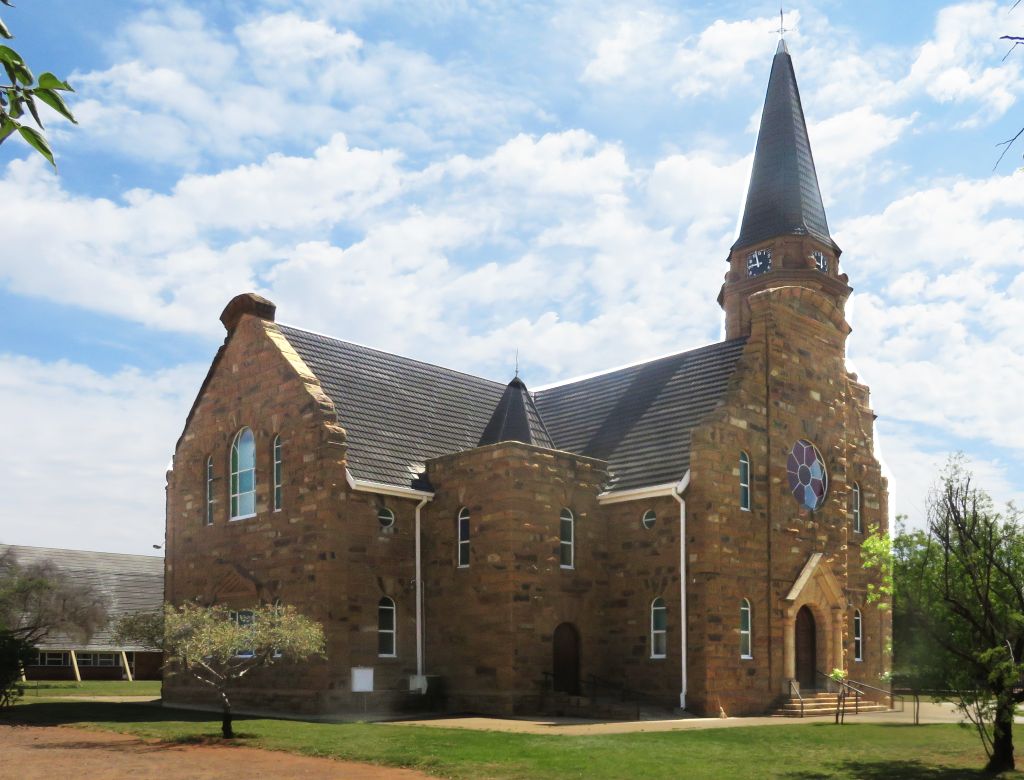
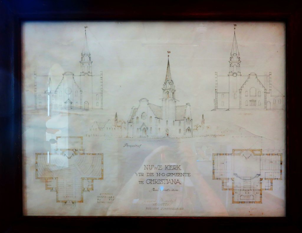 Through the affect of the Anglo-Boer war, the congregation was poor and could not consider a new church building. During the war and a bit after, the congregation could not pay the pastor's salary. But eventually, on the 9-April-1921 the cornerstone could be laid for a new church. The architect was Gerard Moerdÿk. Note the y with the umlaut, this is the way he signed the drawing, shown in the picture. It was one of his early designs, the first one being the church in Bothaville . Money was a problem again and they were unable to complete the tower. This took until 1948 before it could be built.
Railway station
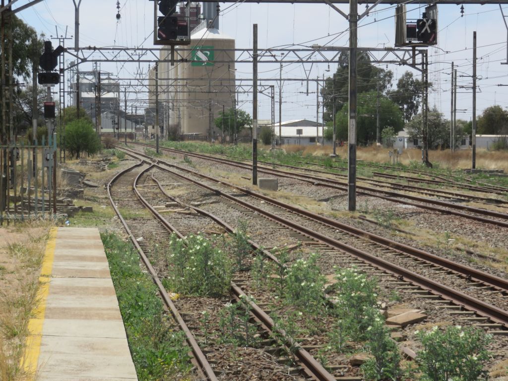 A station on the Kimberley-Johannesburg mainline. It should see lots of traffic, but because of the state of our railways it is down to a trickle. During our visit to Christiana and crossing the line a number of times we did not see a single train passing. The station is not in use and is guarded by two friendly security guards to make sure it does not get vandalised any further.
References
Ref 1.: Standard Encyclopedia of Southern Africa, Nasou Limited, 1974
Ref 2.: "Ons Kerk Album van Hollandsche Kerken en Leeraren", printed by Cape Times, 1917
Ref 2.:
Ref 3.: Emil Holub "Sieben Jahre in Süd-Afrika", subtitle: "Erlebnisse, Forschungen und Jagden auf meinen Reisen von den Diamantenfeldern zum Zambesi (1872-1879)", printed Wien 1881.