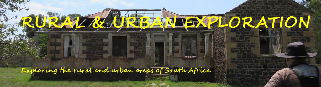
Kaapsehoop
Coming into the village we were ask for a contribution, completely voluntary. The money is needed to maintain the roads, they are not getting any support from the municipality. This would be the municipality of Mbombela (Nelspruit). I am not to sute how this works, but is somehow typical of what is happening in our country. I suppose the inhabitants of the village still have to pay rates to the municipality.
Kaapsehoop is a little village to the south west of Nelspruit, geo position: 25.5916°S, 30.7663°E and 1293m amsl. One sometimes sees the name as Kapsche Hoop, which is the original dutch spelling.
History
I make it easy for myself and quote straight from ref 1: Alluvial gold was discovered in 1882 by the ex-policeman Bernhard Chomse on the farm Berlin near by, and previously by Thomas McLachlan at several places in the De Kaap valley, attracting hundreds of diggers. The extremely irregular nature of the terrain and the bizarre rock formations were the origin of the name Duiwelskantoor (Devil's ofice), possibly given by the surveyor G. P. Moodie. An carly record says: 'No description could convey anything approaching an adequate idea of the difficulties of a journey through this region. The mountains are so rugged that only the devil could live here'. Some of the early diggers, however, saw a resemblance to the Cape of Good Hope and Table Mountain, rising high above the valley, and the incorigible optimism of the gold-secker gave rise to the official name which at that time was written Kaapsche Hoop, and the whole wide valley of 4 000 sq miles (10 000 sq km) was called De Kaap. Small gold and asbestos mines are still dotted about the valley.
 On the mountain top, some I000 metres higher than the valley, the mining commissioner for some years officiated in preference to the hot town of Barberton. Of his office and other government offices, as of the stock exchange, two banks and other business establishments of the gold-rush days, nothing remains, although 233 business and residential stands were surveyed by E. J. P. Jorissen jr. in July 1887.
A note on the commissioners house, the inscription on the building states: The Mining Commissioner's House; 1884; Kaapsche Hoop. Implying that it was build in 1884, but in reference 3 it says that the mining commissioner had a house build from stone at around 1902.
Kommissaris plein

 Translated: Commissioners Square. On that square we find the above mentioned mining commissioners building and the Government building. The Governement building was erected in 1902, it contained a court room,
  two offices, a holding cell, a room for the constable and living quarters. The picture shows the present and what it looked like in earlier days. The building is derelict and not in use, left there as a monument from earlier, golden days.
Little church

 There is a small church at the square. Obviously not from the early days of the settlement, but kept in that style, constructed using corrucated iron sheeting. The interior is kept in a very plain style. I think it was built in recent times. The board near the entrance states: Pronoia Chapel; interdominational church; every Sunday; at 9:00 AM; ALL WELCOME. During a previous visit I noticed that the church is also used as a wedding chapel.
Cemetery

 Outside of town on the other side of the road, romantically nestled between the trees, is the cemetery. A number of graves of the early gold-mining pioneers can be found here. Such as that of William Hayes. The inscription on the reverse side reads, William Hayes; Born 24th June A.D.1845; Died 4th May A.D.1886; He was a jolly good fellow; that no one can deny; he was a jolly good fellow; and so say all of us. One has to assume that he was very popular amongst his fellow miners.
 The Anglo Boer war also left its traces here. Specially noted the grave of SAPPER C,A.Baskerville of the Royal Engineers who died on May 5th 1901. The picture shows the cross placed on his grave, a problem is that during my last visit (April 2024) I could not find it. I have to assume that it has been stolen for its scrap value. The steel railings around the grave of William Hayes has also disappeared.
the Horses

 One of the 'claims to fame' of Kaapshoop are the wild horses which are roaming around the area and sometime even in town. It is not known where they originated from. Two speculations 1. from a group of horses let loose after the Anglo Boer war (1899-1902) and 2. from the change over from horse drawn to mechanical mining methods. The horses are seen as one of the attractions of the town and thus protected by the inhabitants. At this time it is estimated that there are about 200 horses. It is interesting to observe that these horses despite being born free still seek the proximity to humans. Could this be in their DNA?
the hiking trail

 There is a wonderfull hiking trail around Kaapsehoop with a number of overnight stops. Doing the full trail will take 4 days. Different combinations are possible, making it a 1, 2 or 3 day trail. I have been on the trail a number of times.
 The most interesting overnight stop is at the Barrets Coaches. That is exactly what it is, two old railway coaches from the South African Railway. The type that was used for long distance travel with sleeping compartments.
Adams calender

 Along the escarpment for 4 km to the south from Kaapsehoop one finds a garden of upright stones. Studying this assembly, Michael Tellinger came to the conclusion that the stones were placed there representing a calendar. Together with Johan Heine he published a book on he subject, see picture.
Personally I am very sceptical about these claims, but I have not made a full study of the subject. In his website he claims that age of 75000 years has been derived from the fact that some stones line up to sunrise during the winter solstice as it was 75000 tears ago. I cannot see how this sort of accuracy can be achieved considering that the stones are leaning. indicating that the slope is moving. There is also a claim that the three places, Adams Calender, Great Zimbabwe ruins and the Great Pyramid are all lined up on the 31th degree longitude. Checking this on Google earth I get the following: Adams calender 30.76°E, Zimbabwe ruins 30.93° and the Great Pyramid of Giza 31.07°E. Calling this alignment, I think, is a bit far fetched. And think about the times these places were constructed. The great pyramid goes back to 2600 BC, the Zimbabwe ruins to the 11th century AD and Adams calender according to Michael 75000 years ago. Anyway, what is it supposed to mean, all lining up on roughly 31 degrees?
So, what is right? The kids in the picture on the right were obviously receiving a message. They are not telling us what that message was, they must have been sworn to secrecy.
But go and have a look for yourself, its only a total 9 km hike there and back.
Caves
 There are caves in the area. Not the normal caves that we as cavers know of in dolomite, these here are in quartzite. In fact the longest quarcite cave of the country is in the Berlin forest near Kaapsehoop.
References
Ref 1.: Standard Encyclopedia of Southern Africa, Nasou Limited, 1974
Ref 2.: T.V.Bulpin, Lost Trails of the Transvaal, Thomas Nelson and Son, 1965
Ref 3.: the menu of the Bohemian Groove Café restaurant