Oranjeville
A small town surrounded on three sides by the Vaaldam. GPS coordinates: 26.9943°S, 28.21°E, elevation: 1500m
History
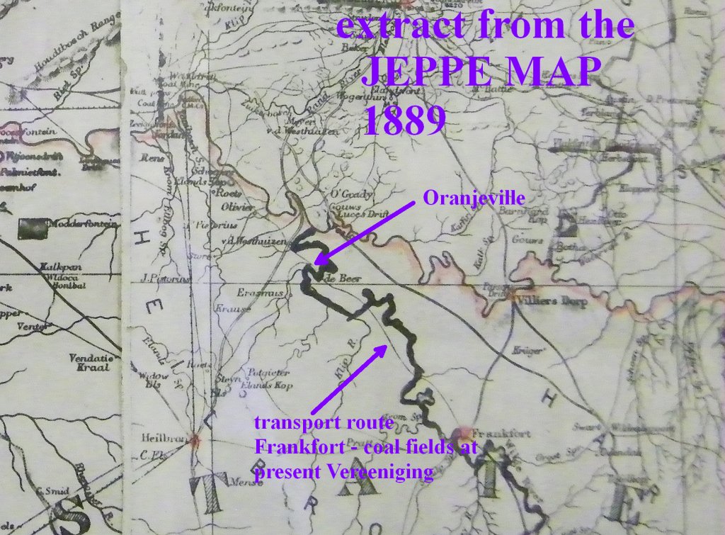
First there was the drift, a place where wagons would cross the Wilge river. An extract from the Jeppe map of 1889 shows a transport route that passes through the Wilge river from Frankfort to, what I presume, the coal fields at what is now Vereeniging. In those days Vereeniging didn't exist, but the coal mines did.
The transport route later changed into a road and a bridge was built over the Wilge river. We were informed that at a low level of the dam (<30%) the old bridge becomes visible. The picture below shows the place where the road went down to the river. It is the extension of Scott street, which used to be the main street through the town.
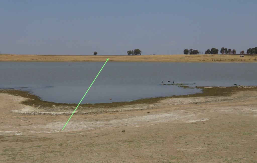 At the waters edge we noticed some stones which looked like they could have been the foundation of a structure, the dam level on that day was 65%. It could be from one of the buildings that had to be abandoned when the area was flooded by the dam in 1938.
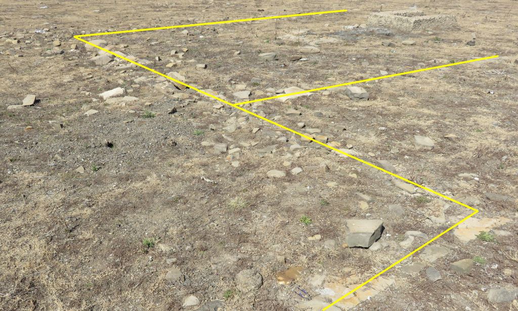 Well, yes, going back there in August 16 when the dam was at 35% it is very clear, the building used to be the blacksmith. This becomes apparent when we noticed heaps of sintered ash and some pieces of metal. The picture shows the walls traced out in yellow. One of the references consulted talks about a blacksmith next to the road over the drift, that was it.
The town itself came into being in 1919, the first stands were sold, by 1920 they had a management council. Initially it was referred to as Zoar. The name Oranjeville has been used from 1920. It was to honour the Dutch Prince of Oranje who had helped extensively with getting the people back on their feet after the Boer War, so I was reading in the literature, I have since been corrected.
There was no Prince of Orange at the end of the Anglo Boer war, it was Konigin Wilhelmina who was the queen of the Netherlands at that time. In Ref 3 it states: 'It takes its name from the Orange Free State, Oranje Vrystaat in Afrikaans'. Where the thought comes from that it was named after the prince can be explained.
My Encyclopedia states that the name of the Orange Free State comes from the Orange River, which is now the Garip. And where did that name come from? It was named in 1779 by a Dutch soldier, RJ Gordon (not a very Dutch name, that is because he came from Scotland), he was the commander of the garrison in Cape Town. He ceremoniously named it in honour of Prince William V of Orange during a visit to the river in the Northern Cape. So, there we are, now we have the connection to the Prince of Orange.
The town was officially proclaimed in 1921.
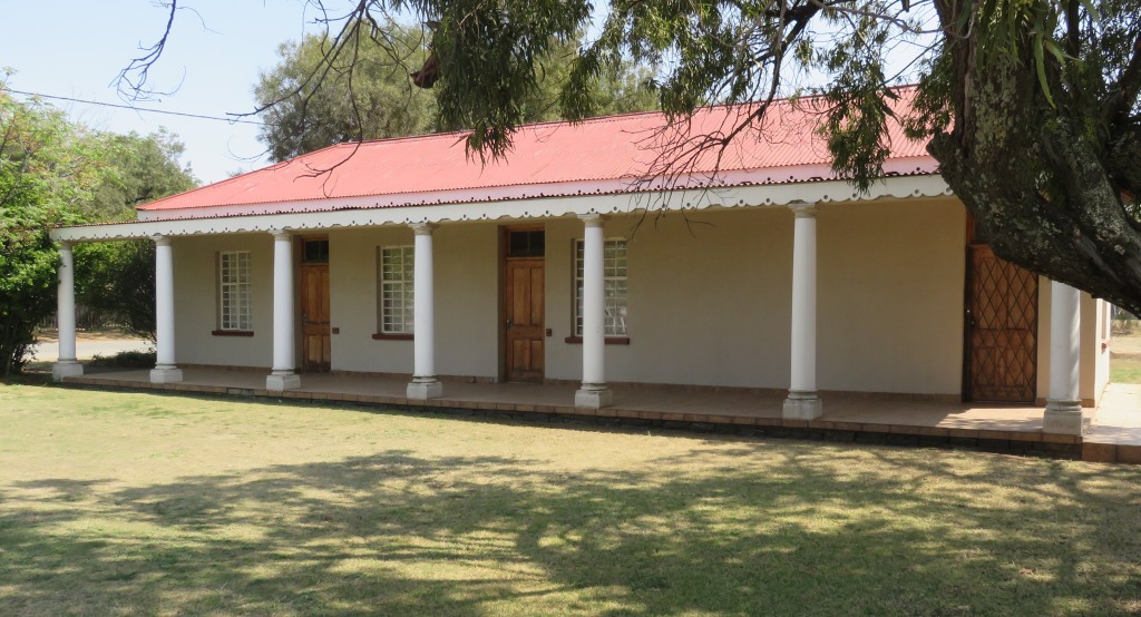
NG church
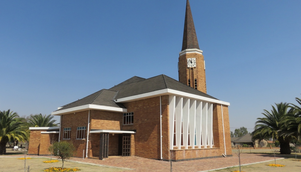 The history of the NG church is closely linked to the history of the town and it can be said that the town was established because of the church.
Members of the NG church living in the area belonged to the Heilbron congregation, and because of the distance to travel to church there they held church services on the farm Rietfontein, that was before 1912. In 1913 a church build, which cost 510 pounds. The building was moved (I presume it was corrugated iron) in 1919 to Oranjeville.
A new church was built in 1949, which is still the present church.
cemetery
 It was our first stop, I didn't expect much, mainly because of the town not being that old. But there are some interesting grave stones.
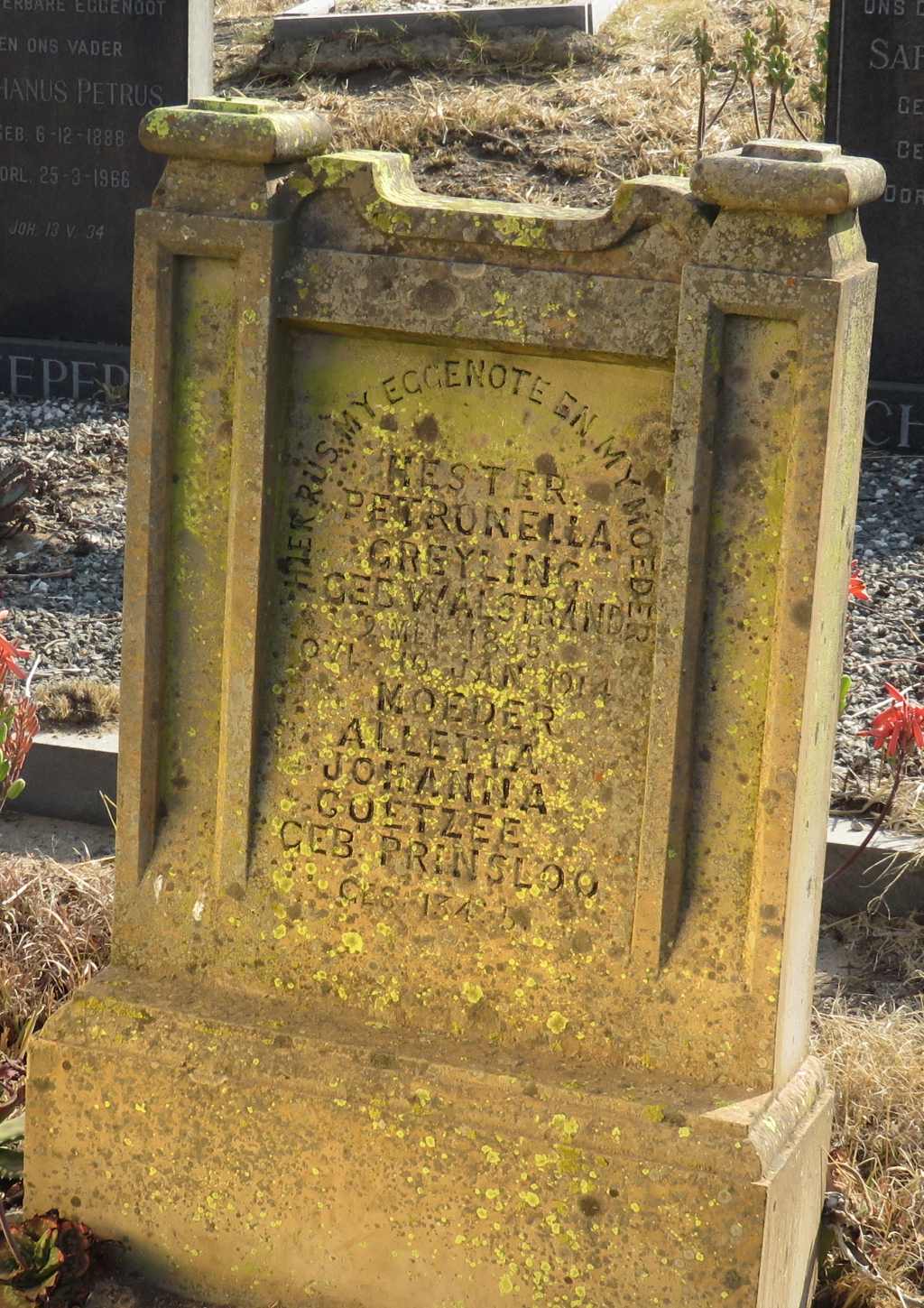
The oldest stone we found is that of Hester Petronella Greyling who died in 1914. This would thus have been one of the graves moved from below the present water line.
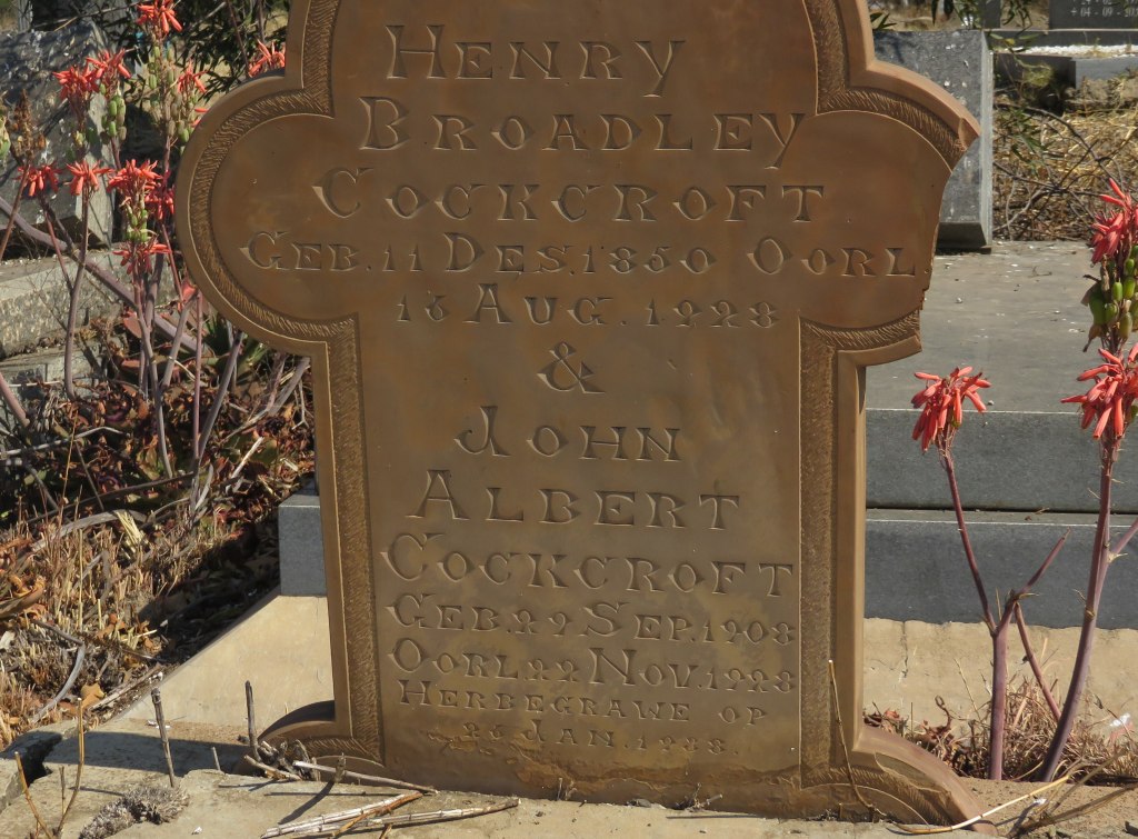
Proving that, here is another grave that of Henry Broadley Cockcroft and John Albert Cockcroft, both died in 1928 and at the bottom of the stone it says: 'herbegrawe op 10 Jan 1938', translated reburied.
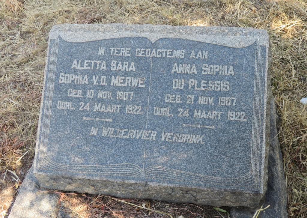 And a local tragedy, two young girls, 14 years of age, drowned in the Wilge River 1922.
Me 109
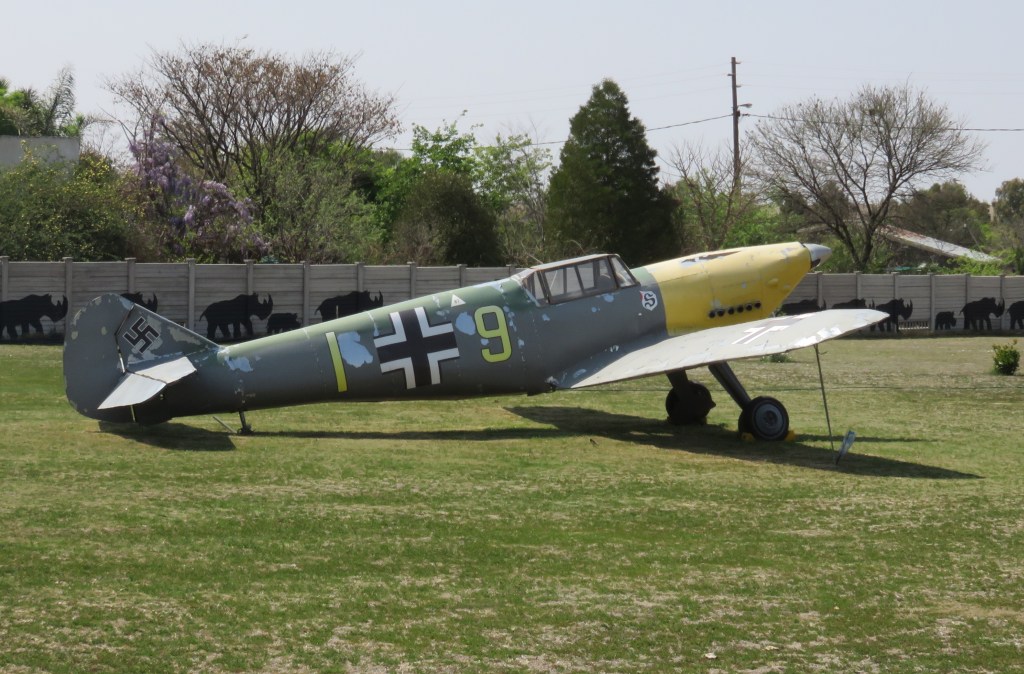
 Yes, that is correct, it's the Messerschmitt Bf 109, the best and most numerous German fighter plane during WW2. I was thus very surprised when, one day driving through town, I find this Me 109 standing in somebody's backyard.
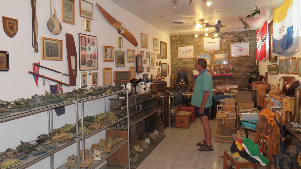
It turned out to be a full scale model (it certainly fooled me from a distance}, built by Dick Scott (no relation to the Scott who Scott street was named after). Dick's hobby is to build and fly model aeroplanes and to collect military stuff (sorry Dick to call it stuff, I can't think of a collective name for the stuff you collect). He has a hanger filled with model aeroplanes hanging from the ceiling and a museum where he keeps his collection. I, certainly, found it very interesting to walk through it and have things explained to me.
And, Dick, just a suggestion, how about building a full scale model of the Me 262, that would make my day.
the Bridge
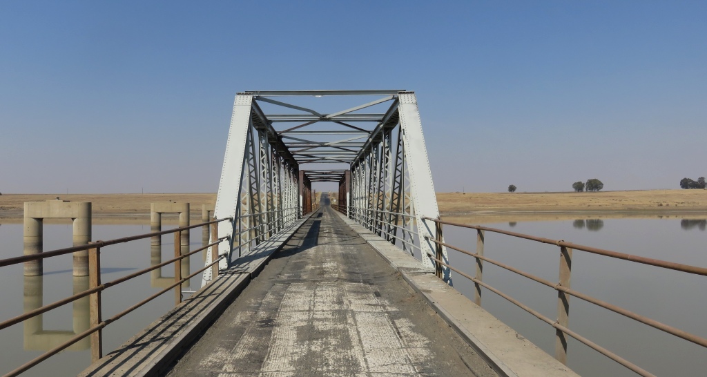 So far I have found no information on when that bridge was constructed, I have to assume it was part of the Vaal dam project, thus built in the second half of the thirties. It has a name, as my topographic map shows, it's the Magrieta Prinsloo bridge. Who was Magrieta Prinsloo? She was one of the survivors, but badly wounded, of the Zulu attack at Bloukrans in 1838.
The bridge is single lane with robots at each end regulating the use of the bridge. I walked over looking for a name plate that would provide information about when and by whom the bridge was built, Nothing, I couldn't even find markings on the I-beams about who supplied the steel.
It looks like some time ago there was an activity to put up a new bridge. Pillars have been erected and than the project was stopped. When this happened I am not sure. I have been travelling on this route for many years and the pillars were there.
the School
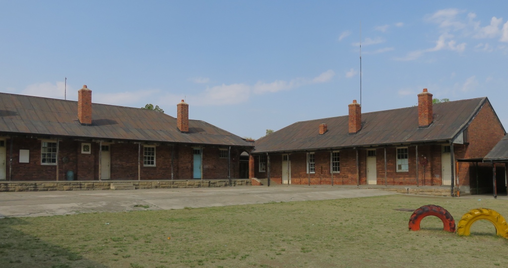 The first school was built in 1919, it is not the present school. Apparently it is still existing, but has been converted to a dwelling, I am not sure where this was.
A new school building was erected at around 1922, exact dates are not in the sources I consulted. The first building had three class rooms and is seen in the picture on the right. More class rooms were added later.
It doesn't look like the school is fully utilised now, a few empty class rooms were noted. And it also looks like maintenance is lacking. A sign post outside states that Sasol is undertaking a refurbishment project here. Why? How did it get to that?
the old policestation
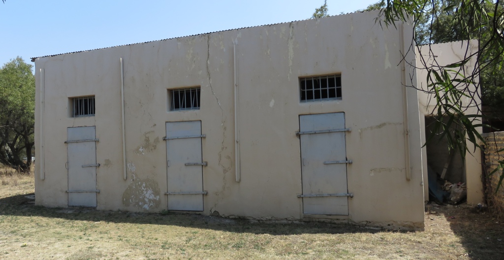 The old police station and the cells are still in existence. The station is being used as a church now. And the cells, I am not too sure, looks like it's used for storage of I don't know what. There is a new police station as one comes into town.
the Oranjeville Riviera
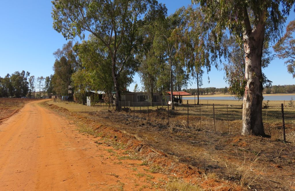 Just to the north of the town is a peninsula, to get to it one has to pass through Metsimaholo. I noticed it on Google earth as having houses along the shore line and I though it would be interesting to go and have a look. The term Riviera is my invention, I don't know what the place is called. At the gated entrance it just talks about a trust.
What happens here is that one can rent a stand for a really minimal fee to be paid once a year. The structure to be put up must be such that it can easily be removed. But that doesn't mean that there are no proper houses built from brick, we noticed a few of them. The situation in that case is that when the owner wants to move off it can be sold to the next occupier. I found this concept very appealing and if I had discovered this place when I was younger I would possibly have developed a weekend place here. And most of the people there are weekenders, although there are a few staying permanently. One drawback is: no water, no electricity, no sewage, no rubbish removal, i.e. absolutely no services. But it has a landing strip, so one can come flying in for the weekend.
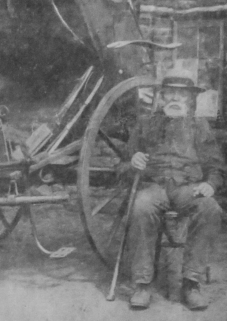
Hermanus Lombard and the death of Captain Elliot
 There is a lone grave yard near the shores of the Vaal Dam on the farm Bultfontein, which is on the Free State side of the dam opposite of Vaal Marina. In it are two graves, only one with a head stone. This is the head stone of Hermanus Stephanus Lombard, he died on the farm Erfbloem 3 May 1930 at the age of 91 years, 9 month and 10 days and was born in 1838, 3 July.
His claim to fame was that he was accused of killing Captain Elliot, which happened in 1880. The background to the story. With the beginning of hostilities in December 1880 at the start of the 1st Boer War, two British officers, captain Lambert and captain Elliot had been made prisoners. They were offered a parole. The conditions were that they must leave the country on the most direct route and they must not further participate in hostilities against the republic.
 They were escorted, which included Hermanus Lombard and sent to Lies drift which was where the Vaal Marina is now, The river had high water and the officers objected to having to cross at the time. The Commandant wanted to know nothing about that and insisted that they cross now. The cart got stuck and the Commandant ordered shots to be fired past the horses and cart to encourage them to move on. One of these shots went wrong and killed captain Elliot. Captain Lambert jumped into the water and made it to the Free State side.
This incident was discussed at the peace negotiations and it was resolved that there should be an judicial inquiry under a judge appointed by the British. Hermanus refused to be in a 'Engelse Hof' (English court) and went off to Betchuanaland to do some big game hunting.
Seven of the members of the escort appeared in front of the judge, with Hermanus not present it was easy to pin the guilt on him, Hermanus Lombard. He had become a fugitive and could not be reached.
When Eugene Marais (Ref 2) interviewed him in 1927 he vehemently rejected the allegation. Thus to this day we don't know who fired the fatal shot and we will never find out.
The story is not very clear on how long he stayed in the Kalahari and how he managed to support his family from there. Eventually he did return and became a well known figure in the district, wandering the district with his cart and horse, gun and revolver always within reach. He was not going to be taken alive. As far as is known there never was an attempt to get him to appear in a court.
There is some uncertainty about where this Lies Drift actually was. The 1879 Jeppe map (see above), shows the name Lombaard at where the Vaal Marina is now. The drift there is marked as Luuis Drift, on an other map also from those days (1881) it's Luces drift. In my opinion this is the drift. The Star (Ref 2) shows the drift further along the river, past the confluence with the Wilge river, approximately where the island is.
Reference:
Ref 1: no specific reference, just a collection of papers made available by the library in Oranjeville
Ref 2: full page article in 'The Star" Saturday, 19 February 1927 by E.N.Marais
Ref 3: PE Raper, 'Dictionary of Southern African place names', Lowry Publishers