
Phuthaditjhaba
Not such a small town in the Eastern Freestate. At last count it had 55000 inhabitants, that is according to Wikipedia, but its not just the numbers, population density is relatively small and it stretches over a wide area. GPS coordinates: 28.5349°S 28.8017°E elevation: 1693m.
Us hikers mainly know this town as the long road through an inhabited area that has to be navigated on the way to the Sentinel car park.
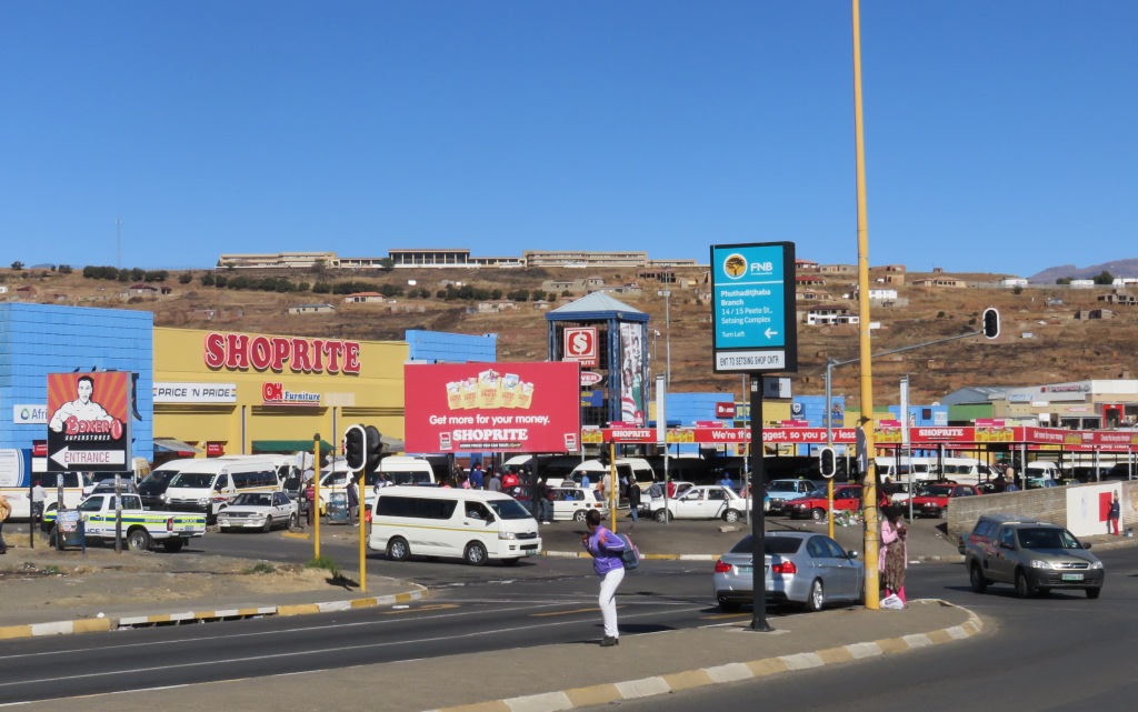 One mystery that I always wondered about is what do people do here? Where does the money come from? There is a large modern shopping centre which shows that there is some affluence around.
People earn money here, we went through the industrial area, we could see it's not running at full steam, but it provides some jobs, not enough tho support the whole town. There are a few cows around, but again not enough to support a town of this size. At least this is what I feel and I am not an economist. I suppose the balance comes from government institutions (university, hospital, administration) and grants from central government (old age, child support).
History of Phuthaditjhaba
The first settlers that came here was a group of Basotos under the leadership of Lephatsoana Oetsi or Witsie. Thus the name Witsieshoek, which was the name of the area before it changed to Phuthaditjhaba. That was at around 1838, San people living there were displaced with the arrival of Witsie. He and his group stayed until 1856. The people were removed by the boers who were suffering from the theft of livestock.
In 1867 separate peace treaty (Basutho war) was negotiated between Chief Paulus Mopeli and President Brand and the tribe was allowed to occupy some of the area. Later in 1873 Chief Koos Mota was allowed into the eastern part of the territory.
The area was later administered by a Native Commissioner with his office in Harrismith. Self-governing tribal authority was established in 1953, at that time in two districts to serve the two tribes living in the area. Those two political bodies were combined in 1969 to form the Basothu ba Borwa territorial authority. This then formed the basis of the self governing Qwaqwa homeland, formally proclaimed in 1974. There was a legislative assembly, a few ministers and the chief minister Wessels S. Mota a grandson of the original Chief Koos Mota.
 When and how the town of Phuthaditjhaba was established is unknown, sometime around 1974. As stated in Ref 1, 'a town which came into being when South Sotho started to stream back into Qwaqwa from all over South Africa'. And this is not political propaganda, one of our informants told us that he used to stay near Harrismith and followed the call by the chief to move to Phuthaditjhaba.
NG Mission station
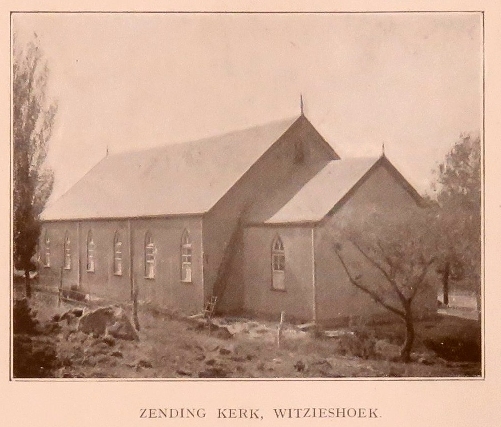 We were looking for the oldest church in the area (see picture from ref 2) and found a whole mission station.
 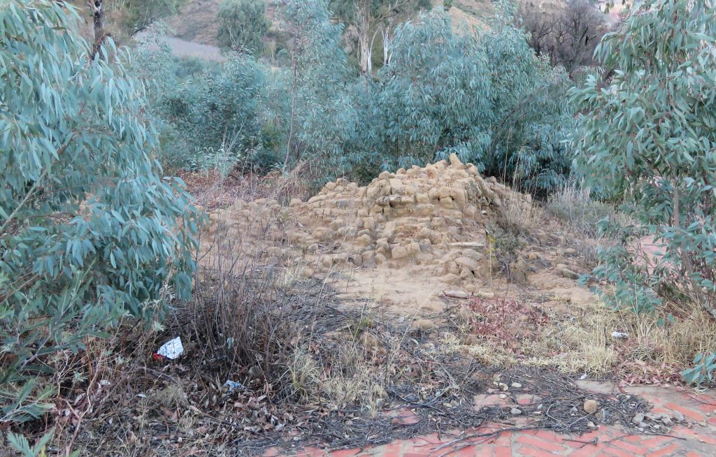 We searched high and low for this church and were eventually sent to a modern church, but met somebody there who knew. He took us to the place where the church used to be. All we found was some foundation stones and a heap of rubble. But this was not a total loss for us, we had lots of fun tracking down this place.
That church was part of a mission station started by the NG church (Dutch Reformed) in 1874. Mission work was at the invite from chief Mopeli. The first missionary was Gustav Maeder, his claim to fame is that he had one of the first irrigation channel constructed in South Africa.
The most prominent missionary was JJ Ross who served the community from 1889 to 1934. It was under his direction that the church was built. The big hospital in Phuthaditjhaba is named after his wife, Elizabeth Ross.
 The first church was constructed in 1898 but didn't stand very long, it was blown over by a storm. A new start was made in 1899. Interesting is that the church was built using mud bricks. It was completed in 1900, construction obviously unhindered by the the Boer War, which was in full progress at that time. Building costs were £1115, of which about half came from the local community and the other half from collections amongst the churches in the Free State.
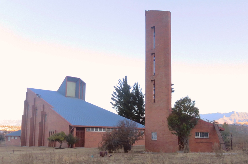
The church lasted until 1994, so we were told, the missionaries fled the area when the change to democracy happened and the church was destroyed by some locals claiming it to be full of bad spirits. After the dust had settled the missionaries returned and a new church was erected at the bottom of the hill. Shown in the picture on the left.
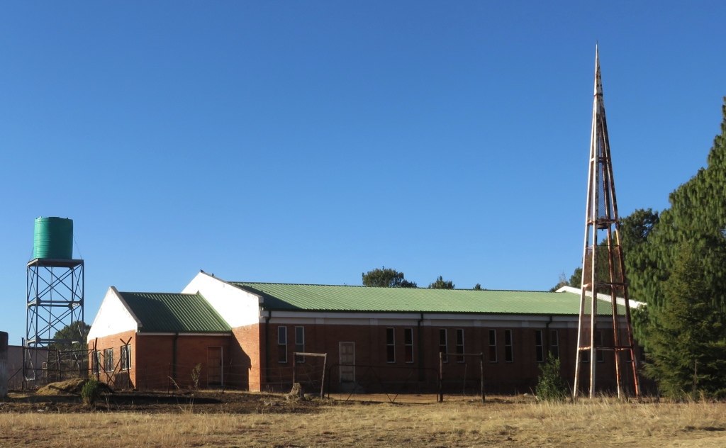 It came to a split in the congregation, I don't know the details, and most of the congregation went off to form a new group. And, I think, their church is further up towards the Sentinel and called NG church in Africa, see picture on the right. The style of the building is similar to that of the old church, could that just be coincidence?
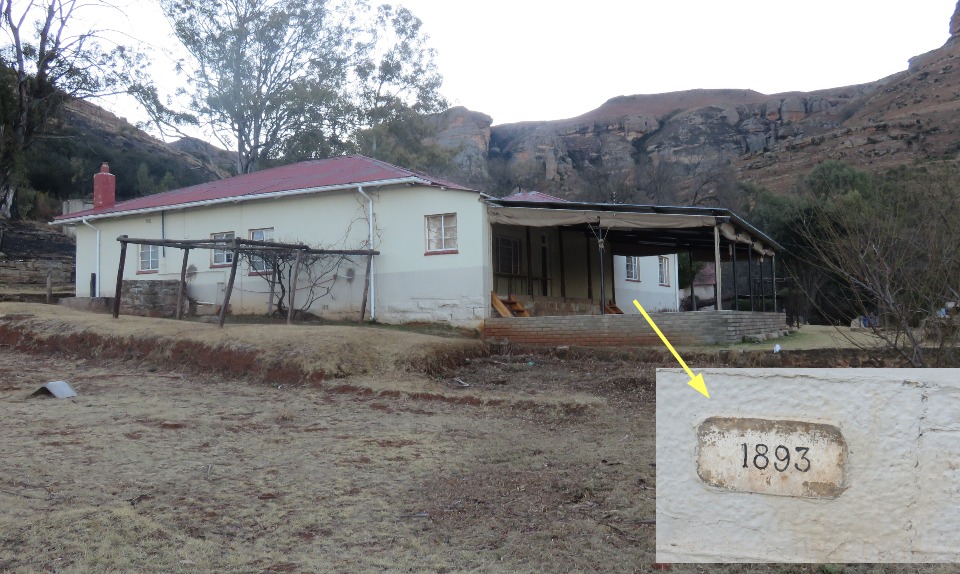 The mission station is not just one house, its a complex. Included in it is a theological college and a number of houses for the mission staff. The house in the picture was erected in 1893 and I presume is the house JJ Ross lived in during his tenure.
Namoha Battle Site
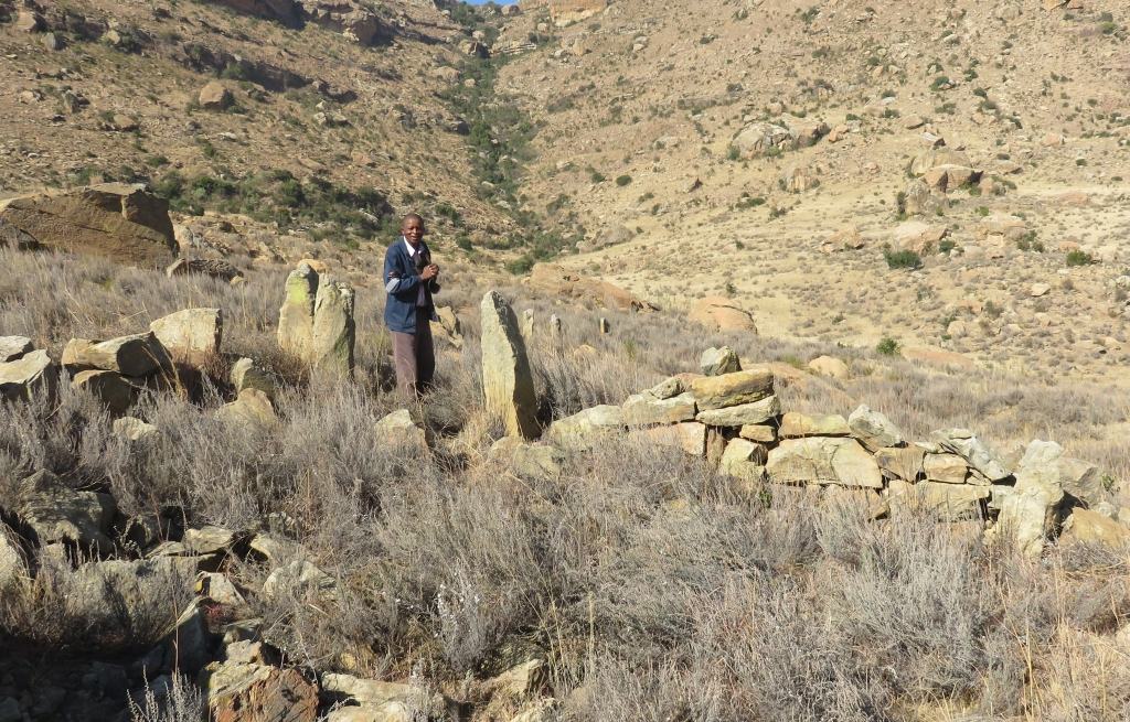 Using the term battle is possibly not quiet right, it was a disagreement between the tribe and the police. But it did lead to loss of life, 14 from the tribe and two policemen. That was on the 28 November 1950.
 The background to the event is that the native commissioner in Harrismith had been trying for some years to reduce the number of cattle grazing on the tribal land. Saying that in the long term over-grazing will lead to a reduction in carrying capacity. I think we have here the classical 'problem of the commons'. There was a lot of unhappiness about this request amongst the people, it eventually led to the confrontation between the Basuthu and the police.
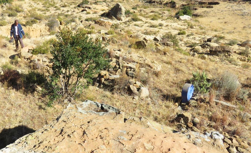
We were directed to the battle site but were unable to find the nine graves of the victims buried in the Namoha grave yard. What we did find were ruins of what used to be huts and kraals, as well as a small grave yard of six graves.
the road to the Sentinel
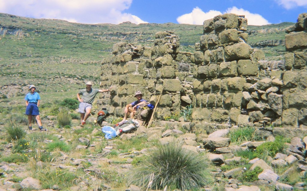 The road to Witsieshoek, which is at the far end of Phuthaditjhaba towards the Drakensberg was constructed in 1928. This was partially to enable traffic over the Namahadi Pass to and from Basutoland, as it was called then. The importance of this pass can be seen by the fact that a police post was built near the top on the South African side.The picture from my archives shows the ruin how it looked like in 1994.
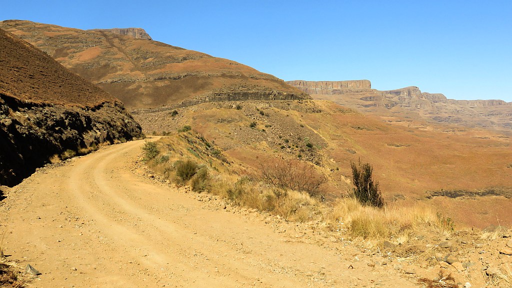 In 1967 the Free State undertook to push the road forward with the aim of taking it up the mountain linking Lesotho. Looking at these mountains I find it difficult to see how they were going to take it up without some tunnelling or major concrete work. But then I am not a road builder.
The road was taken to a point now called the Sentinel car park. Hikers can drive up to there to make this a starting point for a hike to the Tugela Falls, the top of Mt aux Sources or further along the mountains. A toll has to be paid to access this road, we paid R60 in July 2015.
 I do know that there was road construction work going on up from the police post to the shoulder into Lesotho. I have hiked that unfinished road on a number of occasions.
The road to the car park is at times difficult to drive on because of a deteriorating surface. But things are improving, there is construction work to improve the surface considerably by putting down interlocking bricks. The sections that have been done so far show no wear and tear and are in a very good condition.
Witsieshoek Hotel
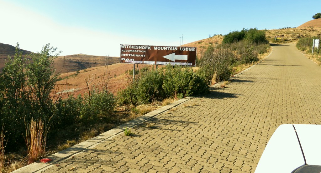
It's called Witsieshoek Mountain Resort now. I have fond memories of this hotel, having stayed there a few times and having used it as a stop over for a bar lunch when hiking up from Royal Natal. I was thus very shocked when I found this youtube video of somebody walking through some ruins and the title says "Witsieshoek abandoned mountain inn" at https://www.youtube.com/watch?v=w9UaxTjrIGg . It was essential to go and pay the place a visit. There was a surprise, we found an expanded hotel belonging to the community of Phuthaditjhaba. It looks well looked after and well managed. So what happened here? The video was taken in a derelict building which used to be part of the hotel. I feel this is a bit dishonest and the video should be re-named.
Parliament building
This was the parliament building erected in the time when Phuthaditjhaba was part of the QwaQwa homeland. A stately building situated on top of a mountain overlooking the town, something that I always thought to be wrong. It doesn't symbolise government by the people for the people, its more like the palace of a ruler. It is now used as municipal offices.
We went there, the gate was open and had a look. The building has been renamed and a large oversized bust placed in front of it. The name meant nothing to us and also the two security guards, who came over to protect the bust had no idea. And I was not allowed to even take a picture of the name plate. To take pictures I must come in during working hours and go to the office to get permission. Stuff them! I am not interested any more in who the building was named after, I took photos from outside the fence, but decided not to have a picture on this website. They don't deserve to have a picture of that building published here.
If you really want to see it, it's the structure on top of the hill in the shopping centre picture.
References
Ref 1.: Standard Encyclopedia of Southern Africa, Nasou Limited, 1974
Ref 2.: "Ons Kerk Album van Hollandsche Kerken en Leeraren", publisher: unknown, printed 1917
Ref 3.: RO Pearse, "Barrier of Spears", Southern Book Publishers, 1989
Ref 4.: Heritage Free State, the nominated sites for declaration in the Free State province, to be found at, well, yes, I can't get this link to work. Just enter "heritagefreestate.co.za/files/dossier.pdf" into the search and it will come up.