Reitzburg
Reitzburg doesn't exist, but it used to, that was in the time of Gold mining in the area. The name of Reitzburg it got from the president of the Free State in the 1880th, Reitz. GPS coordinates: 27.0210°S 27.2095°E elevation: 1366m.
General Dealer
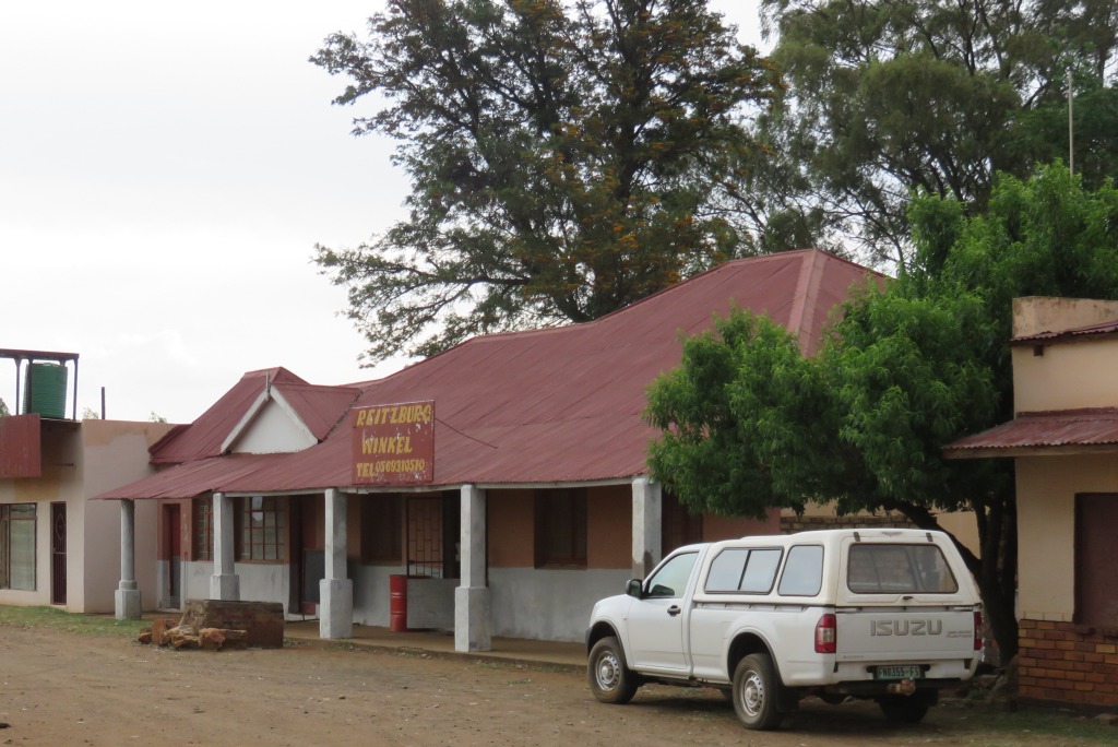
 Basically what is left of Reitzburg is the general dealer run and owned by Johann Roustof. Johann has done some research and established that the building was erected in 1933.
In times gone by the building also housed the post office. The room occupied by the post office is now part of the shop, the place where the wall was is still very visible. And what Reitzburg also had was a police station, this was over the road from the shop. Nothing is left of it now, just a few bricks scattered around a big eucalyptus tree.
School
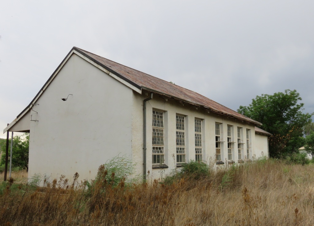
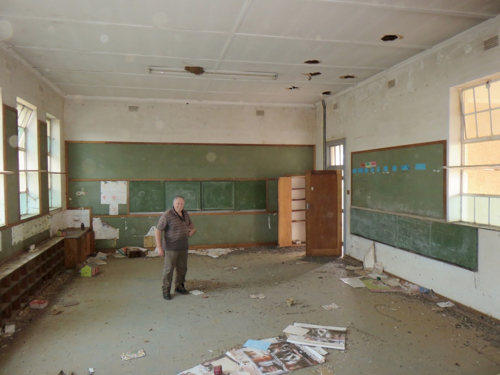 The school is no more, it did function until fairly recently. It was a primary school. One has to wonder why it has been closed, is it because of insufficient numbers or is it because of rationalisation?
There was another school building near the grave yard, that one doesn't exist, just the foundations.
Gold
The area around Reitzburg saw a gold rush in the late 19th century. In March 1886 Mr.Lindeque announced that he called an inspector from the Witwatersrand to check his farm for the presence of gold. The source doesn't state where the farm was, but I have reasons to assume that it was in the vicinity of Reitzburg. The inspector did find gold on his farm, as well as on the neighbours farm belonging to Mr.P.de Necker.
A definite fact is that on the 27 July 1887 the owner of the farm Lindequesfontein no.618, Daniel Hercules Marx applied to the government of the Free State to declare his farm a public digging. In support of this application he sent a box of rocks extracted from the reefs to the magistrate in Kroonstad. The government appointed a geologist, Johan Holleman of Potchefstroom to test the samples. He found the results 'very satisfying'. In addition he took it upon himself to do a personal inspection of the farm. He prepared a very positive report and concluded that profitable mining would be possible. The estimated gold concentration was around 16 dwt per ton, that is 25 gram per ton of ore.
The reef they followed was the Veldschoen reef, so named after a sample from that reef was stored in a veldschoen (a shoe handmade by the boers). It is actually a series of reefs running parallel to each other. In ref 5 one can see these reefs following the curvature of the dome. The other reef exploited in the area was the Aasvoel reef situated to the west of the Veldschoen reef.
The application to declare a public digging was granted on the 1 December 1887. The farm Lindequesfontein is to the west and south of where the general dealer store is now.
A problem for the government and the potential miners was that there was no legislation in place to regulate such a rush. Thus they very quickly issued an ordinance for that in October 1887, it allowed for the appointment of a mining commissioner and establishment of a diggers committee.
Diggers started streaming in, the cost of claims went as high as £150. Success was short-lived, the inspectors report of 1891 already pointed to poor results from the diggings. But president Reitz encouraged the diggers to carry on. The report of 1892 was the final straw and the governement decided to de-proclaim the diggings.
There was a revival in the 1930th, with one mine near Schoemans Drift known to have pushed under the river (Vaal). This was the Great Western mine, it followed the Aasvoel reef on the farm Elandslaagte and operated from 1933 to 1941. But that must have been the second time, it is reported in Ref 4 that the mine produced 855 ounces of gold in 1909. This mine also suffered from the uncertainty, on a number of occasions it came to a pause until the reef was found again. The problem in the area with mining for gold in general was the geological history. The meteor strike, 2 billion years ago, brought the reefs to the surface but also scattered them somewhat.
Grave yard
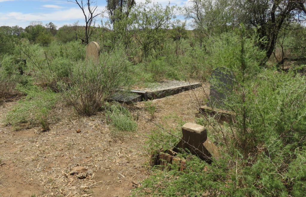 This overgrown grave yard is not far from the shop and I have to assume it was the grave yard for Reitzburg. There are only a few marked graves, six, and a larger number of unmarked graves, means no head stone. Names that appear on the head stones: Gericke, Marx. leRoux and Schoeman.
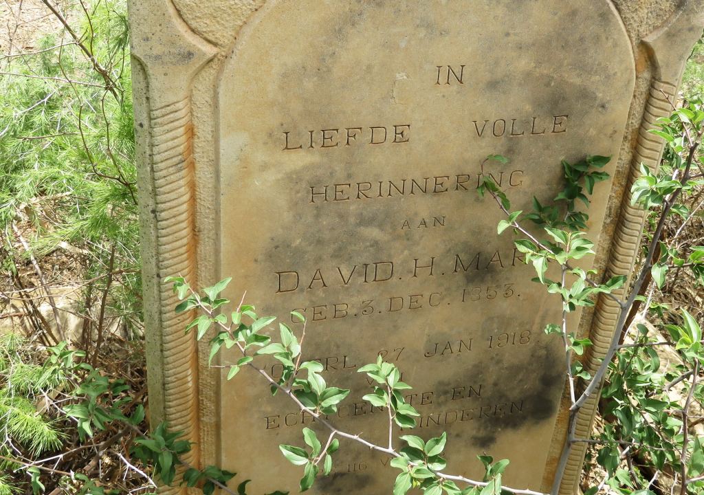 The name Marx means something, a Mr Marx owned the farm Lindequesfontein no.618 in this area. I wrote about him higher up, he applied in 1887 to have his farm declared a public digging. His grave stone reads David H Marx was born 3-Dec-1853 and died 27-Jan-1918.
Which reminds me we have to visit again, there is a place on the topographic map marked as a digging, need to check it out.
Well, yes, it was done, but unfortunately the places shown as diggings turned out to be quaries for road building.
Boer War
The area saw a fair bit of action during the Boer War. General de Wet had a camp near Reitzburg before crossing over at Schoemansdrift to escape the British. Before it came to that there was the
Battle of the Flour Wagons
The general and his force had crossed the railway line at and near Heuningspruit, moving from there toward the Vredefort mountains. He had four wagon loads of grain delivered to the Mackenzie mill in Vredefort with instructions to mill this as fast as possible and to finish the job before the British arrived. The mill worked through the night and the flour was loaded onto the wagons and at first light they went off at the greatest speed the oxen could pull. But alas it was too late, the British were on their way and captured the wagons.That was the 24 July 1900.
This, of course, was a major problem to the Boers. Without food it is difficult to fight a war. When Gen. de Wet received the report his reaction was immediate ordering his forces to attack and retrieve the wagons and it's content. It was an unusual battle for the Boers in that they had to attack without any cover, it was on open flat veld, no place to hide behind. They would leave their horses behind and lay flat on the ground to shoot at the enemy. Most of the action was at or near the farm Stinkhoutboom.
The result of the battle was that the Boers had to return empty handed. The wagons were lost to the enemy. A number of British and Boers lost their lives, 5 and 4 respectively. The remains are buried in the Vredefort cemetery, see pictures in Vredefort.
References
Ref 1.: Standard Encyclopedia of Southern Africa, Nasou Limited, 1974
Ref 2.: VE d'Assonville, 'Generaal De Wet in die Vredefortkoepel', Marnix Pretoria, 2010, ISBN: 978-0-620-46619-6
Ref 3.: Chistiaan Rudolf de Wet, 'Three Years War', Charles Scribner's Sons, New York, 1902
Ref 4.: A.P.Cartwright, The Gold Mines, Purnell & Sons, 1962
Ref 5.: J M Jansen van Rensburg, 'Geoconservation of abandoned goldmines and granite quarries in the Vredefort Dome World Heritage Site, South Africa'
Ref 6.: Military History Journal, Vol 15 No 4 - December 2011
Ref 7.: Eeufees Kroonstad Centenery, editor PJ Germishuys, printer O.V.S. Afrikaanse Pers Bpk Kroonstad, 1975