Sharpeville
A black township between Vereeniging and Vanderbijlpark. GPS coordinates: 26.6874°S 27.8704°E elevation: 1476m.
It is what is commonly called a township, that is a black township. Such a thing, of course, doesn't exist any more. Anybody can live anywhere, but I would be surprised to find a single pink person living in Sharpeville.
And why did I include this in my 'collection'? It's because of the Sharpeville massacre in 1960. A tragic, but also very significant event, in that it marked the beginning of the end of apartheid.
History of Sharpeville
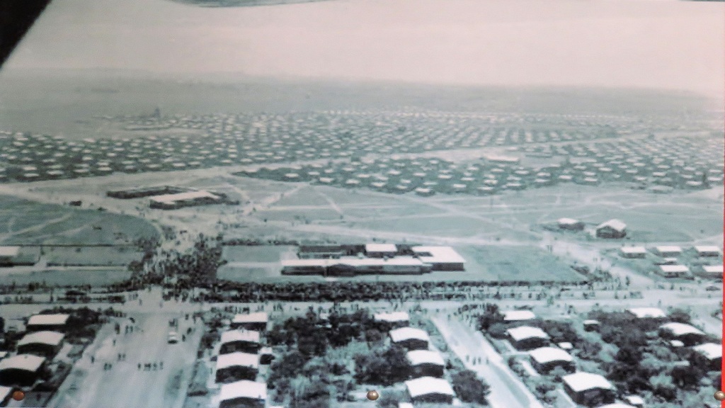
The history of Sharpeville starts with Toplocation. Check the map below, it is an extract from the topographic map surveyed in 1954. 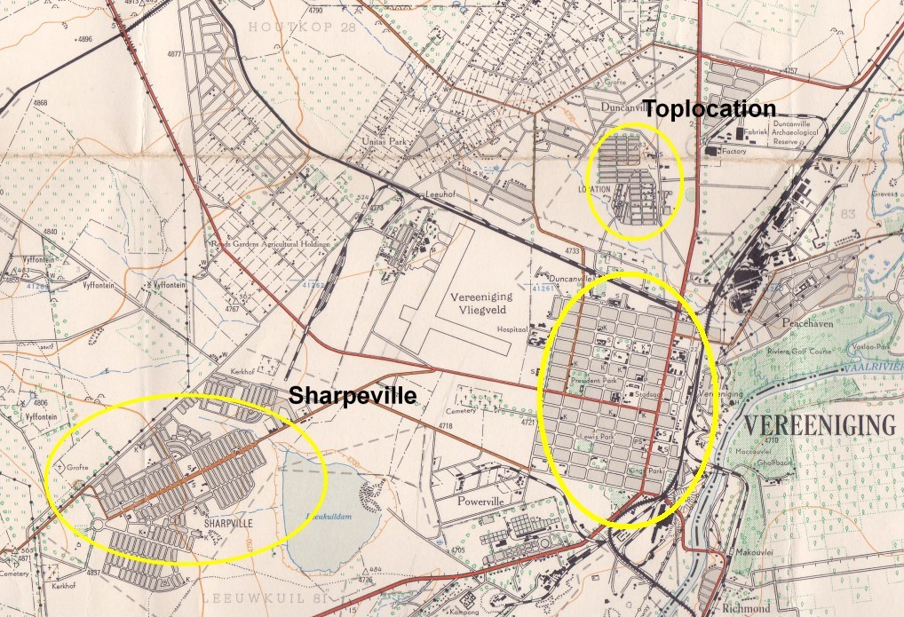
An area where blacks and Indians could live was proclaimed by the town council in 1914, Toplocation was born. That was an area to the north of the town. Before that Blacks used to live informally around the town.
Due to influx of people because of the work opportunities created by the growing industry, Toplocation very quickly became overcrowded. And it was for this reason that the town council of Vereeniging decided to establish a new area for black settlement. This was going to be Sharpeville, but initially called Sharpe Native Township.
And why the name Sharpe? It has been named after John Lillie Sharpe, he was the mayor of Vereeniging from 1935 until his death in 1937. He was known to be well disposed towards the natives and did much for their welfare. The Sharpe Native Township was established in 1935. Houses were built by the town council for rent, ownership under the system at the time was not allowed. And only residents of Toplocation could apply for houses, the aim was to empty Toplocation with the view of its eventual closure. This, of course, was not a very successful strategy because of the continuous influx of new people to the area. Toplocation despite all these efforts stayed 'full'.
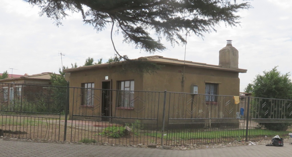
 The first houses built were referred to as 'elephant houses', why that name? I don't know. It was a square lay out and had clay tiles as roofs.
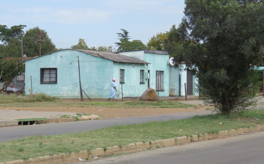
Another type was the one with the rounded roof. The roof was corrugated iron, each sheet shaped accordingly spanning the whole house.
The Sharpeville massacre
 This refers to the event of the 21th of March 1960 during which 69 people lost their life's and many more were injured.
The best account I found in Ref 1 and 4, but also on the internet there is information about it, look at Sharpeville massacre. The unanswered question still is who started to shoot and why. According to the
Truth Commission which looked at the events in 1996 concluded that the crowds at the police station were peaceful, there was thus no reason to shoot. It looks like its left to the individual reader to decide what happened. It may help to look at some of the pictures on the net to come to some conclusions. Especially one of the pictures taken from behind the police line shows a crowed that seems to be non-belligerent, although on care full study some sticks can be seen. And, of course, it is not known at what stage during the event this picture was taken. For our visit to Sharpeville we brought our own survivor, David Nkosi, who is showing us where he was when the shooting started. He is also not sure what happened, not being near the gate and thus out of the line of fire.
 The protest was organised by the PAC, which was/is a break away organisation from the ANC. It looks like they were not a small organisation at the time and at least in Sharpeville had significant support. As the poster shows they still exist and still commemorate the event. Although nowadays they are a minor organisation with no seats in parliament.
The Sharpeville memorial
 There are actually two of them, there is what I consider the major one at the scene of the shooting and another one at the cemetery.
Opposite the former police station is the monument to commemorate the event, it was inaugurated o the 21-March-2002. It is very symbolic, blocks of stones representing each fatality spread over the complex, a fountain with thin jets of water representing bleeding wounds and a channel carrying the water through the centre representing blood flowing in the street.
Next to the memorial is the gallery, it contains a series of pictures and posters related to the incident. My feeling, there is more space available, it should be filled with more pictures and artifacts. I have been told they are working on this.
The Sharpeville cemetery
 Here I am referring to the old cemetery, the one that was in use during 1960. A newer one is on the west side, between Sharpeville and Vanderbijlpark. Here, at the old one, the victims of the event were buried in a long row of graves, see picture. At the east end of the row is a small memorial in the colours of the PAC.
 In this grave yard is also the other big memorial. It is fairly new, inaugurated in 2011. There is some symbolism in this, the centre piece is a square of wooden poles of differing length. The exact meaning escapes me, the number of poles is more than the number of fatalities and injured. Personally I don't understand the need for a second memorial, especially since the place is already showing signs of neglect.
References
1. Standard Encyclopedia of Southern Africa, Nasou Limited, 1974
2. Encyclopedia Britanica Yearbook 1960
3. JW van der Westhuizen, 'Sharpeville, Evaton,and Sebokeng: a short history', Gauteng Provincial Administration Museum Services, July 1997
4. Ramon Lewis Leigh, 'Vereeniging', Courier-Gazette Publishers, 1968