Verkykerskop
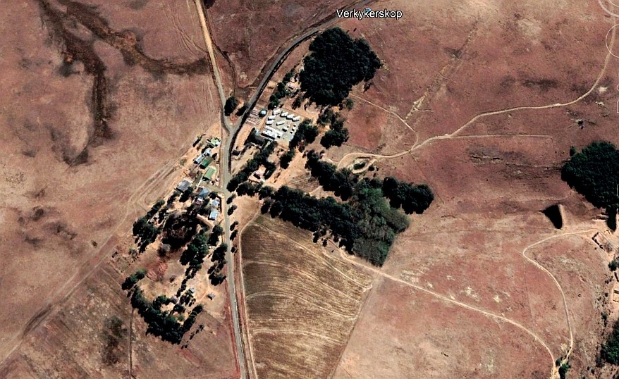 Verkykerskop, a little village or should one rather call it a settlement. Not many people live there, I saw one estimate that says about 20. It's situation is between Harrismith (49km), Warden(36km) and Memel (50km) at the geo-location: 27.9209°S, 29.2796°E and 1911m. The altitude means it will be fairly cool up there, it was cold during our visit. It will be interesting to visit in the middle of winter when snow has fallen.
To write about this place has been very difficult for me, mainly because there is not much information about the history that I could find. When did it start as a village? I am not sure. The name existed at the time of the Anglo Boer war (1899-1902). It was mentioned as a line of blockhouses stretching from Harrismith to Verkykerskop.
The name originates from a mountain top by that name. There is some uncertainty about which mountain it is, opinions of the locals seem to differ. I thus have to accept the position given on the topographic map 2729CC. It is the lower top to the north east of Tafelkop, the massive mountain just to the west of the village. The height is given as 1970m. The story told is that the farmer, who had lots of land, would go up to the top to check out what was going on on the farm using a telescope or binoculars.
 It has to be assumed that the village started with a trading store. In one of the Internet sources it also talks about an outspan, a place where the oxen could be out spanned and allowed to graze.
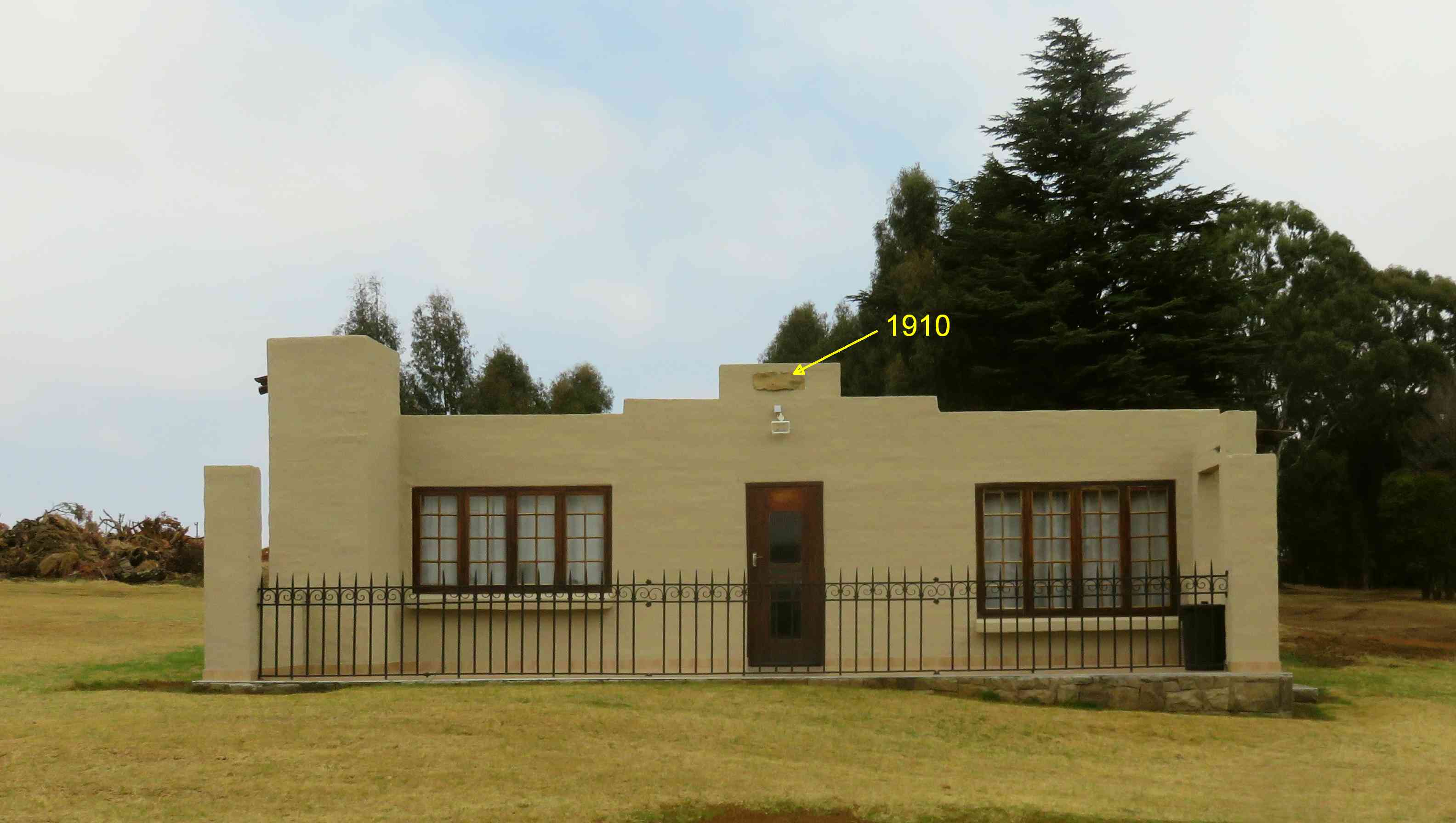
When refurbishing one of the houses a stone with the year 1910 chiselled in, was found and has been reincorporated into the gable of the house. The 1910 would have been the year when the building was first erected.
The village is privately owned, not all of it. The hall of the Boere Vereeniging (farmers association), the old post office and the police station are on public land. It's about 15 years ago (around 2006) that the village was sold by the Boere Vereeniging to a private investor. Plans were drawn up to develop the place for residential and as a tourist attraction. Some work was done, but by 2019 it changed hands again and is now under new management.
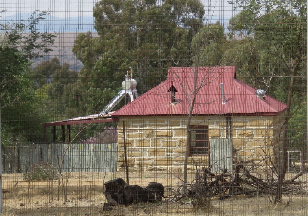 Some of the old houses have been refurbished and converted to tourist accommodation. The old school with a single class room, looks like was built in the early 19 hundreds, see picture on the left. Sorry about the quality, the big fence around the police station was in the way.
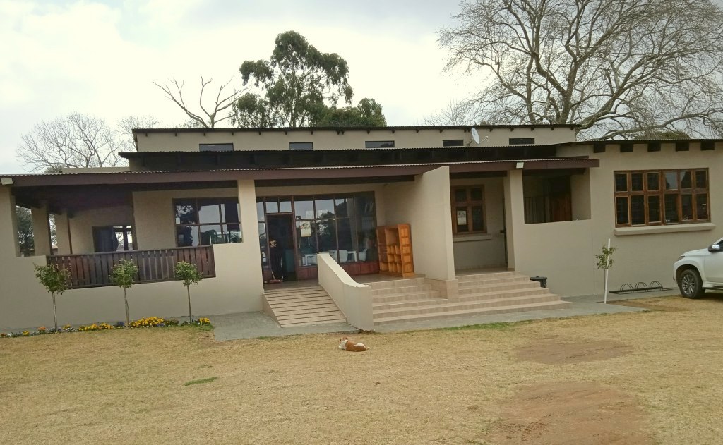 A new coffee shop/restaurant has been built. The old shop, which used to be the general dealer, had been converted by the previous owner to a pub, tea garden, restaurant and antique shop. This has now been closed awaiting new plans.
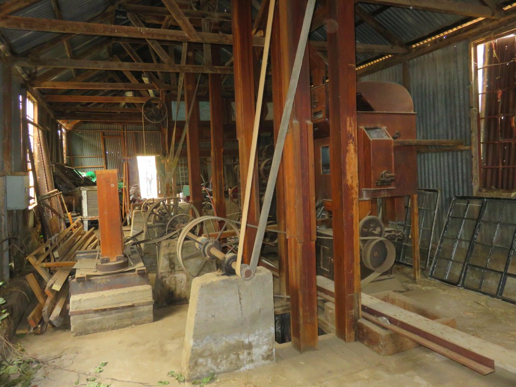
Of the 'old stuff' there is the mill, in a corrugated iron shed, next to the general dealer. The milling machinery is still in the building, some of it will be moved into the new restaurant to serve as decoration. The milling machine was a product of E.R.&F.Turner of Ipswich in England, a well known manufacturer of milling equipment.
 The police station is new, it was only constructed in 2005. But there was an older building for the police, I have no information what it looked like and when that was built. One building still left from the older days ic the cell block. Just note, the sandstone tiles of the building corners were added when the new station was build.
The present owner has definite plans to upgrade the place further. A wedding venue is under construction, it includes a chapel on an island in the dam. Personally I wish him success with this endeavour, it's good to see there are still entrepreneurs around who invest their money in this country.
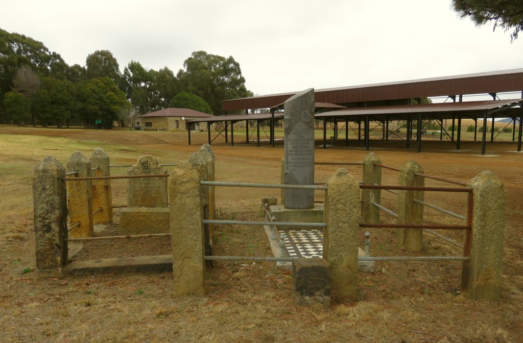 On the site are two graves, the inscription reads(semicolon indicates a line break): In lieftevolle herinnering; aan; my dierbare seun; en ons broer; Joe T.Lee; geb. 20 Nov. 1900; oorl. 30 Julie 1936; rus in vrede; sy plek is leg, sy stem is stil; ons swyg, o Heer dit was U wil.
And the other gravestone: in memory of; Charles Robert; Spencer; died 14th September 1909; aged 28 years; rest in peace. He apparently died in a riding accident.
References
Ref 1.: Cobus Dreyer, Environmental report "ARCHAEOLOGICAL AND CULTURE HISTORICAL ASSESSMENT OF THE PROPOSED RESIDENTIAL DEVELOPMENTS AT VERKYKERSKOP", 2008